
Photo tours by topic
Trailheads and access points
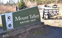
Location and Arrival
Trail characteristics
Signage and Wayfinding
Operations and Maintenance
Trail facts at a glance
Video
Map
Amenities and Features
Mount Talbert Nature Park is a forested volcanic butte nestled between Interstate 205 and Happy Valley, approximately 10 miles from downtown Portland. With various habitats and more than 4 miles of trails, it is a prime destination for those looking to exercise, picnic or experience nature.
Mount Talbert is the largest in a string of extinct volcanoes and lava domes that stretch across the east side of the region. It has been shaped for nearly 3 million years by fountains of lava, floods, fires and people.
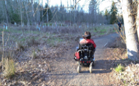
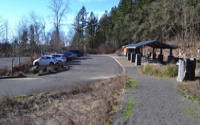
There are five trailheads that lead to the trails on Mount Talbert. The two main trailheads are accessed from SE Mather and SE Sunnyside Roads. Mather Road is the main entrance to the park. Here you will find a large parking lot, two accessible unisex restrooms, a covered picnic shelter, a short gravel trail with interpretive displays near a small native prairie, in addition to the trailhead to the summit. There is a TriMet bus 156 stop uphill, about 500 feet to the east.
From Sunnyside Road, there are a small number of designated parking spaces for Mount Talbert separate from a larger parking lot for Miramont Pointe. There is also a Trimet bus 155 stop directly at the entry road. Both bus routes start from the MAX Green Line station at Clackamas Town Center.
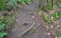
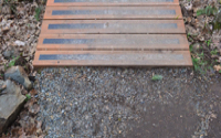
The surface of the trail begins with hard-packed soil combined with compacted gravel. There may be loose gravel at points. This wide trail leads to a raised bridge over Mount Scott Creek with steps at both ends of the bridge. After the bridge, the trail works its way through a small switchback to a junction with the Cedar Park Trail. Stay on the Sunnyside Road Trail. Soon the trail changes from the wide compacted gravel surface to a narrow, and rugged trail with many roots, ruts and rocks crossing its path.
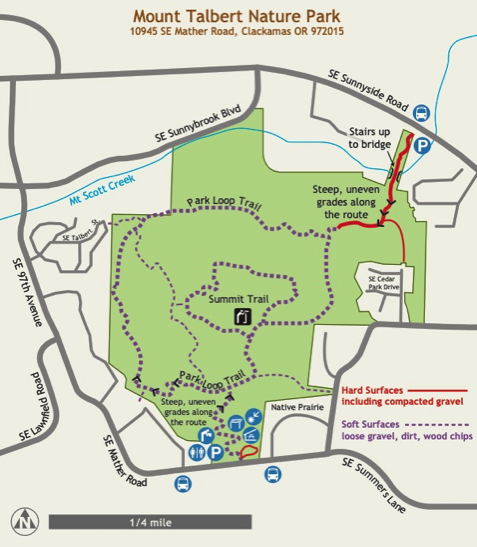
Other than the short gravel trail at the Mather Road access, and the Sunnyside section of trail as far as the bridge, we consider the trails at Mount Talbert to be difficult, due to their rocky, narrow and steep nature. If you do make it to the summit, there is one obstructed viewpoint remaining to the south. Other views are obscured altogether. Blacktail deer frequently feed here in the early evening.
Mount Talbert Nature Park
Metro
Name: Mount Talbert Nature Park
Parks agency: Metro
Contact: Parks and Nature (503) 797–1545
Location: two primary trailheads with parking: 1) SE Mather Road and 2) SE Sunnyside Road, at SE 117th Ave, and two secondary trailheads
Hours: open half hour before sunrise and close half hour after sunset
Public transit: TriMet bus 156 stops 500 feet east [uphill] of SE Mather Rd parking lot; Trimet bus 155 stops at Miramont Pointe. Both buses start from the MAX Green Line at Clackamas Town Center.
Length: AR has no single, recommended route – lengths will vary
How difficult do we consider it: very difficult due to steep and irregular terrain, lots of exposed roots and stairs at the bridge over Mount Scott Creek
Date of last visit: October 27, 2021
Description
Click map image for larger map