
Photo tours by topic
Overview
Location and Arrival
Amenities and Features
Trail characteristics
Signage and Wayfinding
Operations and Maintenance
Trail facts at a glance
Video
Map
The Mt Scott Creek Trail begins at Southern Lites Park, a neighborhood park off Sunnyside Rd on 117th Ave. There is on-street parking on 117th Ave or you can take TriMet bus 155 which stops at the junction of 117th Ave and Sunnyside Rd, about 1/3 mile from the park. Mt Talbert Nature Park [4 miles of predominantly steep trails] can be reached by going south from this bus stop. Going north to Southern Lites Park, there is a crosswalk across Sunnyside Rd, but there is no continuous sidewalk to the park. 117th Ave is a wide residential street.
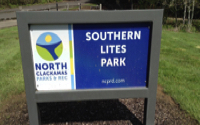
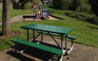
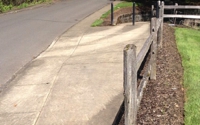
Southern Lites Park is a three-acre park with benches, a playground and a basketball court. Although they are not ADA accessible, these features do have an accessible route to them. Follow the sidewalk through the park to the beginning of the Mt Scott Creek Trail. The trail soon changes from paved to hard-packed soil and loose gravel as you enter a more natural environment. As trail surfaces change, transitions may be higher than 2 inches depending on trail maintenance.
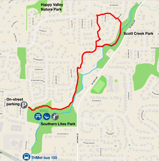
Next, you will encounter a section of boardwalk that follows along Mt Scott Creek. This forested section of trail follows the twisting nature of the creek. This boardwalk has no edge protection and may be slippery when wet. After leaving the boardwalk, the trail again transitions to natural surface and loose gravel. There is a short section of 14% grade here before the trail again becomes paved, ending at a residential neighborhood.
A sign at this location contains a map indicating where to find your desired trail connection. You can also use your smart phone to snap a picture of the QR code for directions. From here you can choose to follow the trail to Happy Valley Nature Park or other destinations where you may encounter extremely steep grades and numerous obstacles on the trail surface. This is the location where AR chose to add a short loop with minimal grades and obstacles, as indicated on the Access Trail map and video.
The AR trail loop follows a neighborhood sidewalk a short distance before reconnecting with the Mt Scott Creek Trail. The next two trails in the loop will also be connected by crossing neighborhood streets and sidewalks. The final trail in the loop is in the Cedar Creek tributary, a beautiful section of trail along Cedar Creek. This trail will lead back to the same location the loop began. There is one short paved section in this loop with a grade of 17%.
After completing AR's chosen loop, double back on Mt Scott Creek Trail to your initial arrival point. The entire trip is approximately 1-3/4 miles and a leisurely two hour hike. Other than the benches at Southern Lites Park, there are no benches, drinking water or restrooms along this route.
Mt Scott Creek Trail
Happy Valley Parks & Recreation
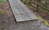
Name: Mt Scott Creek Trail and Southern Lites Park
Parks agency: City of Happy Valley Parks & Recreation as of 2020
Contact: Chris Sliwks (503) 783-3844; General office (503) 783-3800
Location: Southern Lites Park, 12088 SE 117th Ave, Happy Valley, OR
Public transit: TriMet bus 155 at SE Sunnyside and 117th 1/3 mile south
Length: 1.75 miles – loop and side trips recommended by AR
How difficult do we consider it: moderate with some very steep sections
Date of last visit: October 22, 2021
Description

Click map image for larger map