
Video
Map

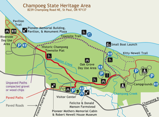
Compacted gravel trail from the visitor center through the Manson Farmstead farm to the barn

Paved trail leading from visitor center to day use areas and campground – long steep downhill grade

Paved trail with a slight lip to the wooden bridge with railing

Crosswalk where the trail from the visitor center goes across to the paved trail

Paved bike path to Oak Grove – disc golf and campground – crack on the left side of trail – bench

Transition from paved trail to natural surface trail – the transition may have a small lip

Townsite trailhead – garbage can – signage prohibits bikes – grass is growing through light bark chip surface

Natural surface trail goes through the woods – sign says bikes prohibited

Natural surface trail goes to Riverside day use area – parking lot
Trail characteristics
Champoeg State Heritage Area
Oregon Parks and Recreation Department
Click map images for larger maps
Overall map
Detail map