
Photo tours by topic
Overview
Location and Arrival
Amenities and Features
Trail characteristics
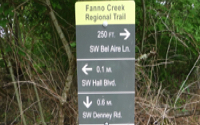
Signage and Wayfinding
Operations and Maintenance
Trail facts at a glance
Map
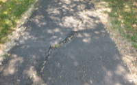
Fanno Creek Greenway Trail connects communities in the Metro region from Portland to Durham. It weaves through 5 cities and 2 counties providing a multi-use trail for walkers, runners, bicyclists and trail enthusiasts of all ages. This 15 mile recreational and commuter trail is designed according to ADA accessibility standards, although, the paved surface may have the occasional crack crossing its surface.
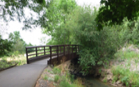
Access Recreation staff chose a portion of this trail totaling 1.8 miles. They started their hike at the northernmost point of Fanno Creek Park. It has a small parking lot with accessible parking and a distinctive fish shaped bike rack. It is located on the south side of Denny Road. The bus stop is at the southernmost point of the park on Hall Boulevard. Both are connected by the Fanno Creek trail. This trail segment is .7 miles in length.
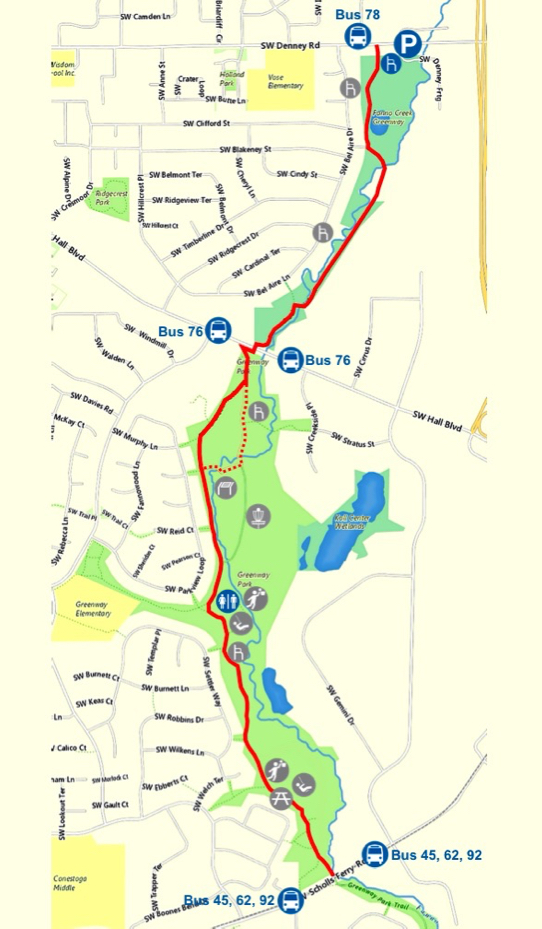
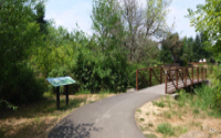
Fanno Creek Park is part of the Fanno Creek floodplain and mainly consists of grassy and wooded wetlands. The trails include boardwalks, natural and paved trails, and bridges that traverse the Creek. There is a gazebo for small, public gatherings. We followed the paved trail to Hall Boulevard.
There is an audible crosswalk signal at Hall Boulevard leading to Greenway Park where the Fanno Creek trail continues. Greenway Park is a scenic park featuring trails with marked junctions, a disk golf course, numerous sports courts, playgrounds and picnic areas.
A trail user can stop anywhere between Hall Boulevard and Scholls Ferry Road and find numerous things to enhance their park experience. On our visit, part of the trail was detoured to preserve beaver dam activity. It was interesting to see the beavers’ handiwork further downstream. Another unusual feature was the several art installations throughout the park providing inspirational messages.
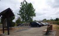
Benches and picnic tables are found along the trail and near the different features. There is a covered picnic area as well as one accessible porta potty available on site.
Greenway Park is 1.1 miles in length with Trimet bus line #78 at Denney Rd, and Bus #76 at Hall Blvd, both towards the north; and bus lines #45, #62 and #92 at Scholls Ferry Rd to the south.
Both parks are open daily from dawn to dusk.
Fanno Creek Greenway Trail
Tualatin Hills Park & Recreation District
Description
Name: Fanno Creek Greenway Trail [between SW Denney Rd and SW Scholls Ferry Rd]
Parks agency: Tualatin Hills Park & Recreation District
Contact: Main number (503) 645-6433; maintenance (503) 629-6360; nature and trails (503) 629-6350; park security (971) 246-0169
Location: Starting point at 11020 SW Denney Rd, Beaverton, OR
Hours: dawn to dusk
Transit: Trimet Bus #78 at SW Denney Rd; Bus #76 at SW Hall Blvd; Buses #45, #62 and #92 at SW Scholls Ferry Rd
Length: 1.8 miles from SW Denney Rd to SW Scholls Ferry Rd, one way
How difficult do we consider it: easy—paved and relatively level.
Date of last visit: October 22, 2021
Click map image for larger map