
Video
Map
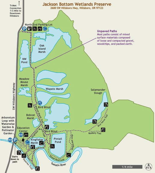
Jackson Bottom Wetlands Preserve
Hillsboro Parks & Recreation
Map
Signage and Wayfinding

Interpretive displays along the railing of shelter – wooden deck – view of refuge

Natural Area Boundary – Sensitive Wildlife Boundary

Sign – ”Jackson Bottom Wetlands Preserve, open dawn to dusk, hiking, nature walking” – no pets or bikes – remove waste

Directional signage with trail map and trail location

Sign – “What are wetlands?” – lands that are wet – productive ecosystem – absorb water/chemicals – watch wildlife

Informational sign shows no hunting, bikes, dogs – directions to Kingfisher Marsh Loop and Riparian Forest Trail

Poison Oak sign in English and Spanish

Sign – “Jackson Bottom Wetlands Preserve – open dawn to dusk – Bobcat Marsh Hiking Trail to education center – 1 mile”

Information board at education center – dry board to record the birds and animals people see – announcements
Click map images for larger maps