Photo tours by topic
4T entire loop overview
T1 Trolley = Streetcar
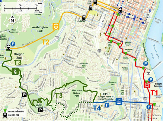
T3 Trail up to Council Crest
T3 Trail down to OHSU Tram
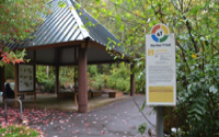
T4 Tram
Trail facts at a glance
Video
Map
T2 Train = MAX

What is the 4T?
With the completion of the Tram in 2006 and the newly-extended Streetcar line serving the new South Waterfront neighborhood, Hillsdale civic leader Don Baack, creator also of the SWTrails walking network [see also Stephens Creek], and his son Eric, conceived of the idea of taking four, seemingly-disparate ways of experiencing the city and combining them into one larger loop of nearly 8 miles.
If Don is the visionary for the loop trail, credit should go also to [recent mayor] Charlie Hales for envisioning the need and benefit for the Streetcar system as a way to better unify the various neighborhoods, and to OHSU for seeing the benefit of the Tram as a way of traveling between the upper campus/hospital and the rapidly expanding lower campus. These projects were ridiculed at the time, but both have proven their worth and incredible popularity with families. This gave PDOT the confidence to construct the recently opened Tilikum Crossing, the only full-size bridge in the US to exclude cars.
How to experience it
As the map to the right indicates there are 4 “T” segments to the “trail” that could be initiated at any point. We prefer to start at the base of the Tram, rather than at the Zoo [which was the original intent]. When the 4T loop was first envisioned this area was still a wasteland, but with the completion of several attractive new buildings and Tilikum Crossing, and with the extension of the MAX Orange Line and Streetcar Loop, this now is an area where one would like to finish the day, perhaps sitting outdoors at Tilikum Crossing [a frappuccino at Starbucks or a margarita at Flying Elephants?].
Having four, discrete segments may prove logistically difficult for some—whereas it’s easy to travel with family on public transit, negotiating 3.5 miles of foot travel may not be suitable for many families—intrepid hikers that have just completed the muddy Marquam Trail may feel out of place riding the Streetcar or standing next to OHSU medical staff in their scrubs.
The Tram schedule is seasonal and closes earlier on weekends [5:00 pm] than weekdays [9:30 pm]. Pet policies vary for the 4 segments. And, unfortunately, during the current pandemic, the Tram is not available for non-hospital use. But various TriMet bus routes serve the OHSU campus and the downtown transit mall. Bring your HOP card.
[M - F]
4T Trail Loop
SWTrails and various jurisdictions
Name: 4T Trail—connecting 4 means of transit to create a large loop
Parks agency: SWTrails [the concept]; Portland Parks & Recreation [the hiking trails]; TriMet [MAX]; PBOT [Tram and Streetcar]
Contact: Don Baack for favorable comments; agencies above for specific concerns
Location: Diverse, multi-modal tour of the west side of the city
Public transit: Streetcar NS or B lines; MAX westbound to Zoo station; Tram down from OHSU [no cost going down]
Length: 8 miles; 3.5miles on foot; 4.5 miles by transit—allow 4 hours
How difficult do we consider it: easy to grueling, depending on segment
Date of last visit: June 25, 2016—information not updated in 2021


Trail segments—numbering sequence is by AR
T1 From the base of the Tram via Streetcar to the MAX at SW Morrison Street
T2 From the MAX at SW Morrison Street to the Oregon Zoo MAX station
T3 From the Oregon Zoo MAX station up to Council Crest
T3 From Council Crest down and then up again to OHSU and the Tram station
T4 From OHSU and the Tram station back to the starting point
Click map image for larger map